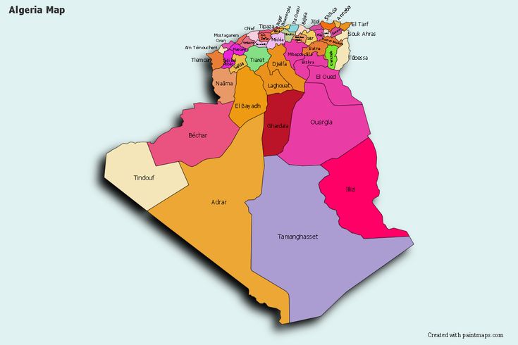
This post discusses the regions in Algeria, the provinces before independence and the provinces in Algeria
Introduction
Algeria, the largest country in the African Continent, also stands out as one of the world’s largest reserves of oil. It is surrounded by the Mediterranean Sea in the north, Tunisia in the northeast, Libya in the east, Niger and Mali in the south, Mauritania in the southwest, and Morocco in the west.
There exist in Algeria many regions. Whether they are cultural, linguistic, historical, or geographical in nature, none are recognized as an administrative unit by the Algerian government. With regards to the administrative structuring of the country, Algeria is divided into 58 wilayas or provinces.
Here are some of the country’s regions:
- Algérois
- Aurès Mountains
- Constantinois
- Gourara
- Hautes Plaines
- Hodna
- Hoggar Mountains
- Grande Kabylie
- Petite Kabylie
- Basse Kabylie
- Eastern Kabylie (Kabylie of Collo, Kabylie of the Kutama)
- The M’zab
- Mitidja
- Annaba region
- The Saoura
- Titteri
- The Tell
- Tidikelt
- Trara Mountains
- Touat
- Oranie
- Chelif River valley
- The Dahra Range
- The Ouarsenis
- The Zibans
- The Algerian Sahara
- Grand Erg Oriental and Grand Erg Occidental
- Souf
- Tassill n’Ajjer
- Tanezrouft
Algeria administratively divided into 48 provinces. The highest governor of each province is the governor. The counties are divided into 1541 municipality. The capital of each province is a municipality, and the capital city is also the largest city.
Before independence, Algeria was first divided into 15 provinces. This division was made under French rule, and Algeria maintained this order for a while after independence. Between the years of 1974 and 1983, 15 provinces were reorganized to 31 provinces. In 1984, 31 provinces were reorganized and today 48 provinces were created.

PROVINCES IN ALGERIA
Adrar
Chlef
Laghouat
Oum el-Bouaghi
Batna
Béjaïa
Biskra
Béchar
Blida
Bouïra
Tamanghasset
Tébessa
Tlemcen
Tiaret
Tizi Ouzou
Algiers
Djelfa
Jijel
Sétif
Saïda
Skikda
Sidi Bel Abbès
Annaba
Guelma
Constantine
Médéa
Mostaganem
M’Sila
Mascara
Ouargla
Oran
El Bayadh
Illizi
Bordj Bou Arréridj
Boumerdès
El Taref
Tindouf
Tissemsilt
El Oued
Khenchela
Souk Ahras
Tipaza
Mila
Aïn Defla
Naâma
Aïn Témouchent
Ghardaïa
Relizane