In this post, we’ll take a look at the regions of Eswatini as well as some basic information about each, such as population data, total area, and the capital city of each.
Swaziland, or the Kingdom of Eswatini, is a small country on the continent of Africa.
It is an entirely landlocked nation, sharing most of its borders with South Africa. To the northeast, it borders Mozambique.
Swaziland is one of the smallest countries in Africa, with a total area of 17,364 km2. The population is 1.16 million as of 2020.
Read: POLITICAL HISTORY OF ESWATINI
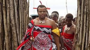
The current king is Mswati III. He has held power since 1986.
Eswatini is divided into four regions:
Hhohho
Lubombo
Manzini
Shiselweni
Each region is further divided into administrative units called tinkhundla, which are then split further into imiphakatsi.
Each of the tinkhundla elects a representative in the House of Assembly.
HHOHHO
In the northwest is the Hhohho region, which King Mswati II established in 1903. The territory is 3,625 km2, and it has a population of 320,651. It has the smallest area of the regions of Swaziland.
Its borders include the Manzini region in the southwest, Lubombo in the southeast, and South Africa to the north and west.
The capital city, Mbabane, also serves as the national capital.
Tourism and forestry are the two primary economic industries that support this region of Swaziland. The hiking trails at the Malolotja Nature Preserve and the Umhlanga Festival are top-rated attractions in the area.
Hhohho has 14 tinkhundla: Hhukwini, Lobamba, Madlangempisi, Maphalaleni, Mayiwane, Mbabane East, Mbabane West, Mhlangtane, Motjane, Ndzingeni, Nkhaba, Ntfonjeni, Piggs Peak, and Timpisini.
MANZINI
The western part of Swaziland is called the Manzini Region, which is 4,093 km2 and home to 355,945 people. Hhohho borders to the north, Lubombo to the east, Shiselweni to the south, and South Africa to the west.
The capital city, Manzini, is a hub for industry and agriculture. The primary processing plants and manufacturers and an international airport are all close to the city center.
This region of Swaziland has 16 tinkhundla: Ekukhanyeni, Hlambanyatsi, Kwaluseni, Lamgabhi, Lobamba Lomdzala, Ludzeludze, Mafutseni, Mahlangatja, Mangcongco, Manzini North, Manzini South, Mkhiweni, Mtfongwaneni, Ngwempisi, Nhlambeni, and Ntondozi.
LUBOMBO
The easternmost region is Lubombo, with an area of 5,849 km2 and a population of 212,531. It is the largest of the regions but has the second-least number of residents.
Lubombo borders all three other regions along the western edge– Hhohho is to the northwest, Manzini to the central west, and Shiselweni to the southwest.
That capital is Siteki.
Lubombo has 11 tinkhundla: Dvokodvweni, Hlane, Lomahasha, Lubuli, Lugongolweni, Matsanjemi North, Mhlume, Mpholonjeni, Nkilongo, Siphofaneni, and Sithobela.
SHISELWENI
The southern Swaziland region of Shiselweni has the lowest population, at 204,111, and is the second-smallest in area, at 3,786 km2.
Both Manzini and Lubombo border to the north, with South Africa surrounding the remaining edges.
The capital city is Nhlangano.
Shiselweni has 14 tinkhundla: Gege, Hosea, Kubuta, Maseyisini, Matsanjeni South, Mtsambama, Ngudzeni, Nkwene, Sandleni, Shiselweni I, Shiselweni II, Sigwe, Somntongo, and Zombodze.

