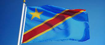
In this post, we discussed the meaning of regions, the history of this regions, the province of the democratic republic of Congo and its capital.
WHAT IS REGION?
Region is an area especially part of a country or the world having definable characteristics but not always fixed boundaries. It is a particular area or part of the world, or any of the large official areas into which a country is divided
HISTORY OF THE REGIONS
These regions are subdivided into 86 districts and 7 communes; which are further subdivided into urban and rural communities. When Belgium a colony in November 1908, it was initially organized into 22 districts. Ten western districts were administered directly by the main colonial government, while the eastern part of the colony was administered under two vice-governments: eight northeastern , and four southeastern districts. Then In 1919, the colony was organized into four districts:
- Congo-Kasaï (five southwestern districts),
- Équateur (five northwestern districts),
- Orientale Province and Katanga (previous vice-governments).
In 1932, the colony was reorganized into six provinces. firstly, they were named after their capital cities, but in 1947 regional names were adopted.
Read: POLITICAL HISTORY OF CONGO
The Belgian Congo became an independent country in 1960, named Republic of the Congo. By 1963, the country was organized into 21 provinces plus the capital city, similar to the original 22 districts under colonial rule. And again 1966, the 21 provinces were grouped into eight, and the capital city was renamed Kinshasa.
Again in 1971 the country was renamed Zaire, and three provinces were also renamed. Then during 1975, the capital city of Kinshasa obtained the status of a province. the province of Kivu was split into three In 1988. The country was renamed Democratic Republic of the Congo 1997, and the three provinces that had been renamed in 1971 either retook their previous name or took another.
Read: STATES AND TERRITORIES OF THE UNITED STATE
Furthermore, Article 2 of the Constitution of the Democratic Republic of the Congo adopted in 2006 specifies a territorial organization into 26 provinces, again resembling the previous regions and original colonial districts. The Belgian Congo became an independent country in 1960, named Republic of the Congo,and then By 1963, the country was organized into 21 provinces plus the capital city were grouped into eight , and the capital city, similar to the original 22 districts under colonial rule. In 1966, the 21 provinces were grouped into eight , and the capital city was renamed Kinshasa.
Also in 1971, the country was renamed Zaire, and three provinces were also renamed. the capital city of Kinshasa obtained the status of a province In 1975. And then In 1988, the province of Kivu was split into three. In 1997, the country was renamed Democratic Republic of the Congo, and the three provinces that had been renamed in 1971 either retook their previous name or took another.
Article 2 of the Constitution of the Congo, adopted in 2006, specifies a territorial organisation in the regions of Congo into 26 provinces, again resembling the previous regions and original colonial districts.

LIST OF THE PROVINCES IN CONGO
| Map | Province | Capital | Area in km2 (sq. mi) |
Population (2019) |
Previous province |
Time zone |
| 1 | Kinshasa | – | 9,965 (3,848) | 13,916,000 | Kinshasa | UTC+1 |
| 2 | Kongo Central | Matadi | 53,920 (20,820) | 6,365,000 | Bas-Congo | UTC+1 |
| 3 | Kwango | Kenge | 89,974 (34,739) | 2,416,000 | Bandundu | UTC+1 |
| 4 | Kwilu | Bandundu | 78,533 (30,322) | 6,169,000 | Bandundu | UTC+1 |
| 5 | Mai-Ndombe | Inongo | 127,243 (49,129) | 2,082,000 | Bandundu | UTC+1 |
| 6 | Kasaï | Tshikapa | 95,631 (36,923) | 3,165,000 | Kasaï-Occidental | UTC+2 |
| 7 | Kasaï-Central | Kananga | 59,500 (23,000) | 3,743,000 | Kasaï-Occidental | UTC+2 |
| 8 | Kasaï-Oriental | Mbuji-Mayi | 9,545 (3,685) | 3,601,000 | Kasaï-Oriental | UTC+2 |
| 9 | Lomami | Kabinda | 56,426 (21,786) | 2,801,000 | Kasaï-Oriental | UTC+2 |
| 10 | Sankuru | Lusambo | 104,331 (40,282) | 2,417,000 | Kasaï-Oriental | UTC+2 |
| 11 | Maniema | Kindu | 132,250 (51,060) | 2,654,000 | Maniema | UTC+2 |
| 12 | South Kivu | Bukavu | 64,791 (25,016) | 6,565,000 | South Kivu | UTC+2 |
| 13 | North Kivu | Goma | 59,483 (22,967) | 7,574,000 | North Kivu | UTC+2 |
| 14 | Ituri | Bunia | 65,658 (25,351) | 4,008,000 | Orientale | UTC+2 |
| 15 | Haut-Uele | Isiro | 89,683 (34,627) | 2,046,000 | Orientale | UTC+2 |
| 16 | Tshopo | Kisangani | 199,567 (77,053) | 2,582,000 | Orientale | UTC+2 |
| 17 | Bas-Uele | Buta | 148,331 (57,271) | 1,250,000 | Orientale | UTC+2 |
| 18 | Nord-Ubangi | Gbadolite | 56,644 (21,870) | 1,425,000 | Équateur | UTC+1 |
| 19 | Mongala | Lisala | 58,141 (22,448) | 1,950,000 | Équateur | UTC+1 |
| 20 | Sud-Ubangi | Gemena | 51,648 (19,941) | 2,755,000 | Équateur | UTC+1 |
| 21 | Équateur | Mbandaka | 103,902 (40,117) | 1,712,000 | Équateur | UTC+1 |
| 22 | Tshuapa | Boende | 132,957 (51,335) | 1,789,000 | Équateur | UTC+1 |
| 23 | Tanganyika | Kalemie | 134,940 (52,100) | 3,570,000 | Katanga | UTC+2 |
| 24 | Haut-Lomami | Kamina | 108,204 (41,778) | 3,444,000 | Katanga | UTC+2 |
| 25 | Lualaba | Kolwezi | 121,308 (46,837) | 2,993,000 | Katanga | UTC+2 |
| 26 | Haut-Katanga | Lubumbashi | 132,425 (51,130) | 5,378,000 | Katanga | UTC+2 |


